Меню
General information
Almaty region is located in the south and eastern region of Kazakhstan. The area is known as “Semirechye”, or in “Zhetysu” Kazakh, with an interesting, rich history and many attractions that are among the must-see places in Kazakhstan.
The territory of the region is 223.9 thousand square kilometers, being the fifth largest region of Kazakhstan by area. Population density is 8.5 people per one square kilometer, by this indicator the region is ranked second after South Kazakhstan region.
The population of Almaty region at the beginning of 2016 amounted to 1.948 million people. The rural population here is predominant - 75.8%, urban residents amount to just 24.2%.
As for the ethnic composition, 70.7% of the population of Almaty region are Kazakhs, the share of Russians amounts to 14.3% and Uighurs are in third place with a share of 7.9%. This given ethnic group is the most numerous particularly in Almaty region.
Almaty region borders two foreign countries: with the Xinjiang Uygur Autonomous Region of the PRC in the east and with the Chui and Issyk-Kul regions of Kyrgyzstan in the south.
Administrative division
The administrative center of Almaty region is the city of Taldykorgan. The largest city of Kazakhstan - Almaty - is also located on the territory of the region, but it is not a part of it by being a city of republican significance.
Almaty region includes 16 districts. There were 10 cities and 731 villages (auyls) in the region at the beginning of 2016.
In addition to Taldykorgan, which has a population of 140.6 thousand people, thare are also Kaskelen (66.4 thousand people), Talgar (48.4 thousand people), Kapchagai (45.4 thousand people), Zharkent (43.4 thousand people), Esik (39.2 thousand people), Tekeli (31.3 thousand people) among larger cities of Almaty region. Moreover, the cities of Kapchagai and Tekeli belong to the cities of regional subordination.
Regional center
The city of Taldykorgan is located in the foothills of the Dzungarian Alatau on the Karatal River. The city was founded on the site of Gavrilovka settlement, which dates back to the middle of the XIX century. In 1920 the village was named Taldy-Kurgan, which is a Russified version of the Kazakh name "taldy korgan", meaning "willow or tallow hill".
In the 1930s and early 1940s the village was the district center of Taldy-Kurgan district of Alma-Ata region. In 1944, Taldy-Kurgan received the status of a city.
In 1967 the city became the regional center of Taldy-Kurgan region, renamed into Taldykorgan after Kazakhstan’s independence. In 2001, the capital of Almaty region was moved from Almaty to Taldykorgan, which has been the administrative center of the region ever since.
History of the region
The Almaty region was formed on March 10, 1932. The administrative center of the region at that time was the city of Alma-Ata, the region included 18 districts.
In the 1930s there were active administrative transformations, during which new districts were formed, a number of territories were transferred to other regions, in particular, Dzhambul and Semipalatinsk. In 1944, Taldy-Kurgan region was separated from Alma-Ata region, which included 11 districts.
In 1959 the city of Alma-Ata was separated from the region, and the region itself was united with the Taldy-Kurgan region, which, however, in 1968 was again separated as an independent administrative unit.
The new unification of these two regions already occurred in the modern history of Kazakhstan. In 1997, Taldykorgan region was united with Almaty region with 16 districts and three cities of region subordination: Taldykorgan, Kapshagai and Tekeli.
In accordance with the Decree of the President of the Republic of Kazakhstan № 585 of April 14, 2001, Taldykorgan became the regional center of Almaty region.
Natural and climatic conditions
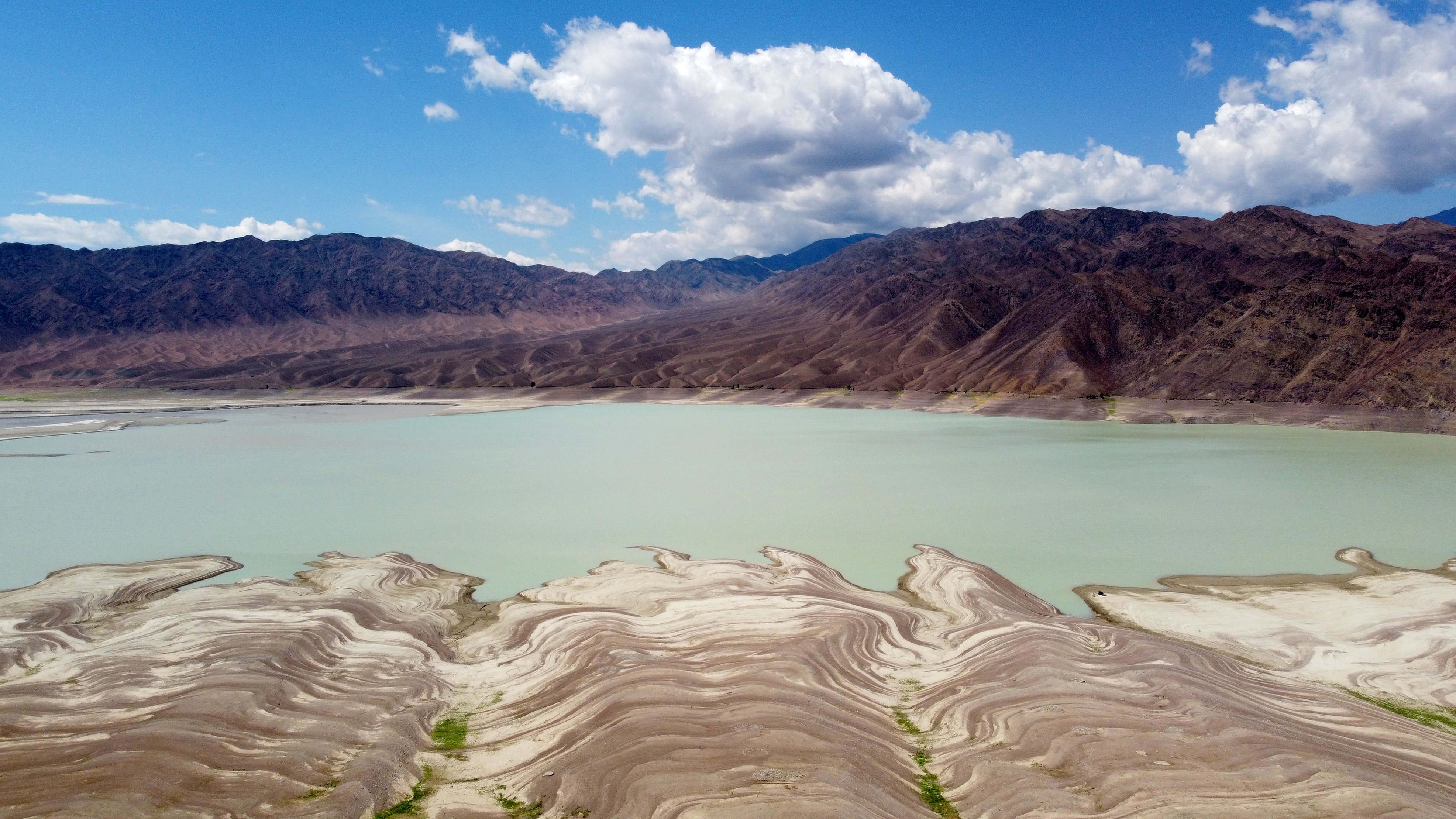
The nature of Almaty region is characterized by rare diversity, it includes 5 climatic zones: from deserts to eternal snows. Alpine meadows and mountain glaciers are located in the south and east of the region in the foothills and mountains of the Tien Shan, where the highest point of Kazakhstan, the peak of Khan Tengri, is located. The plains of southern Pribalkhash and Alakol depression stretch in the north of Almaty region, in the west - Kendyktas mountains, which are a continuation of the Alatau range. The city of Almaty, the largest populated area of Kazakhstan, is located in the foothills of the Zailiyskiy Alatau, a mountain range in the northwest of the Tien Shan.
The vegetation is characterized by great diversity and varies depending on the natural and climatic zones. Wormwood and saltwort vegetation with thickets of saxaul prevail in the foothill semi-desert zone, in the delta and valley of the Ili river - the largest river of the region - thickets of reeds, cane, toga forests. Steppe vegetation of the foothills is replaced by deciduous and then coniferous forests, which often turn into alpine meadows.
The animal world of the Almaty region is also very diverse. Several dozens of species are under special protection and are listed in the Red Book of Kazakhstan. Among them, for example, is the snow leopard, which lives in the mountainous areas in the east of the region. The Almaty Nature Reserve and two of the four national nature parks of the country are located in the region, Ile-Alatau and Altyn Emel.
Water resources are unevenly distributed. In the north and northwest, the only large river is the Ili, which flows into Lake Balkhash. In the south and east, the river network is more dense, most rivers originate in mountain glaciers. Irrigation system is well developed in the region, as of 2015 there were 144 water reservoirs, the largest of which is Kapchagai reservoir.
The climate of the region is also heterogeneous. In the plains, the average January temperature is -10-16 ºC, the average July temperature is 25 ºC, while in the foothills it is -5-9 ºC and 21-23 ºC, respectively.
Reserves of polymetallic, tungsten ores, molybdenum, barite, refractory clay, coal and brown coal, as well as underground mineral waters discovered in the subsoil of Almaty region.
Economy
The economy of Almaty region is dominated by the manufacturing industry. The share of industry in the gross regional product in 2015 amounted to approximately 20%.
In 2015, the volume of industrial production in the region amounted to 553.6 billion tenge, of which 455.2 billion tenge, or 82.2% came from the manufacturing industry.
As for agriculture, in 2015 gross output amounted to 450 billion tenge, which is 5.8% higher than in 2014.
The region is home to the “Khorgos-Eastern Gateway” SEZ, the Khorgos International Center for Border Cooperation, and the active development of six industrial zones.
Tourism
Almaty region is one of the most popular regions for both domestic and foreign tourism. Being part of the Great Silk Road, the region combines a wealth of historical monuments with a unique complex of natural sites.
According to the Akimat (City Administration), the region has more than 550 tourist sites, which were visited by almost 900 thousand people in 2015.
In preparation for Expo-2017, a number of new tourist routes have been developed in the region, including, visits to the state national natural parks "Altyn-Emel", "Ile-Alatau", "Kolsai Kolderi", "Sharyn" and "Zhongar Alatau".
The most famous natural attractions of the region include: Charyn Canyon, lakes Alakol, Big Almaty, Kolsai, Issyk; Turgen Gorge.
On the territory of the region there are Tanbala petroglyphs, which are included in the UNESCO World Heritage List.
Official website of the Akimat of Almaty region https://www.gov.kz/memleket/entities/almobl?lang=ru