Меню

General Information
Kyzylorda region is in the south of Kazakhstan. Kyzylorda region is located in the east of the Aral Sea, in the lower reaches of the Syrdarya River and in the Turan lowland. It borders on several regions of the Republic of Kazakhstan, including the Turkestan region in the East and Southeast, the Ulytau region in the north, the Aktobe region in the Northwest and the Republic of Karakalpakstan in the Southwest, and the Navoi region of Uzbekistan in the South.
The area of Kyzylorda region is 226,000 km2, the third largest region in the country, although its population density is one of the lowest at 3.4 persons per square kilometre.
As of January 1, 2023, the population of the region was 833.5 thousand people, including urban – 391.1 thousand (46.9%), rural – 442.4 thousand people (53.1%). Compared to January 1, 2022, the population increased by 10.3 thousand people or 1.2%.
Administrative divisions
The administrative center of the region is the city of Kyzylorda. The territory of the region is divided into 7 administrative districts. It includes 1 Regional Center – Kyzylorda, 1 city of Republican significance – Baikonur.
Regional Centre
Kyzylorda city developed on the banks of the Syrdarya River. It dates back to 1817, when these lands were under the rule of the Kokand Khanate, and the construction of the Akmechet fortress began on the bank of the Syrdarya.
After the annexation of the territories around the Syrdarya and the Aral Sea by the Russian Empire the fortress was renamed Perovsk in 1852, in honour of General Perovsky, who led the capture of the fortress. In 1862, fortress Perovsk was given city status.
In 1922, Perovsk returned to its old name Akmechet, but by 1925 the city had become known as Kzyl-Orda, meaning ‘red capital’ in Kazakh. On 15th April 1925, it was decided to make Kzyl-Orda the capital of the Kazakh Autonomous Republic as part of the Russian Soviet Federal Socialist Republic (RSFSR). In 1929, the capital was transferred to Alma-Ata, and Kzyl-Orda returned to being the centre of the district In 1938, Kzyl-Orda became the administrative centre of Kzyl-Orda region.
In 1997, by decree of the President of Kazakhstan, the city’s name was changed from Kzyl-Orda to Kyzylorda.
Baikonur
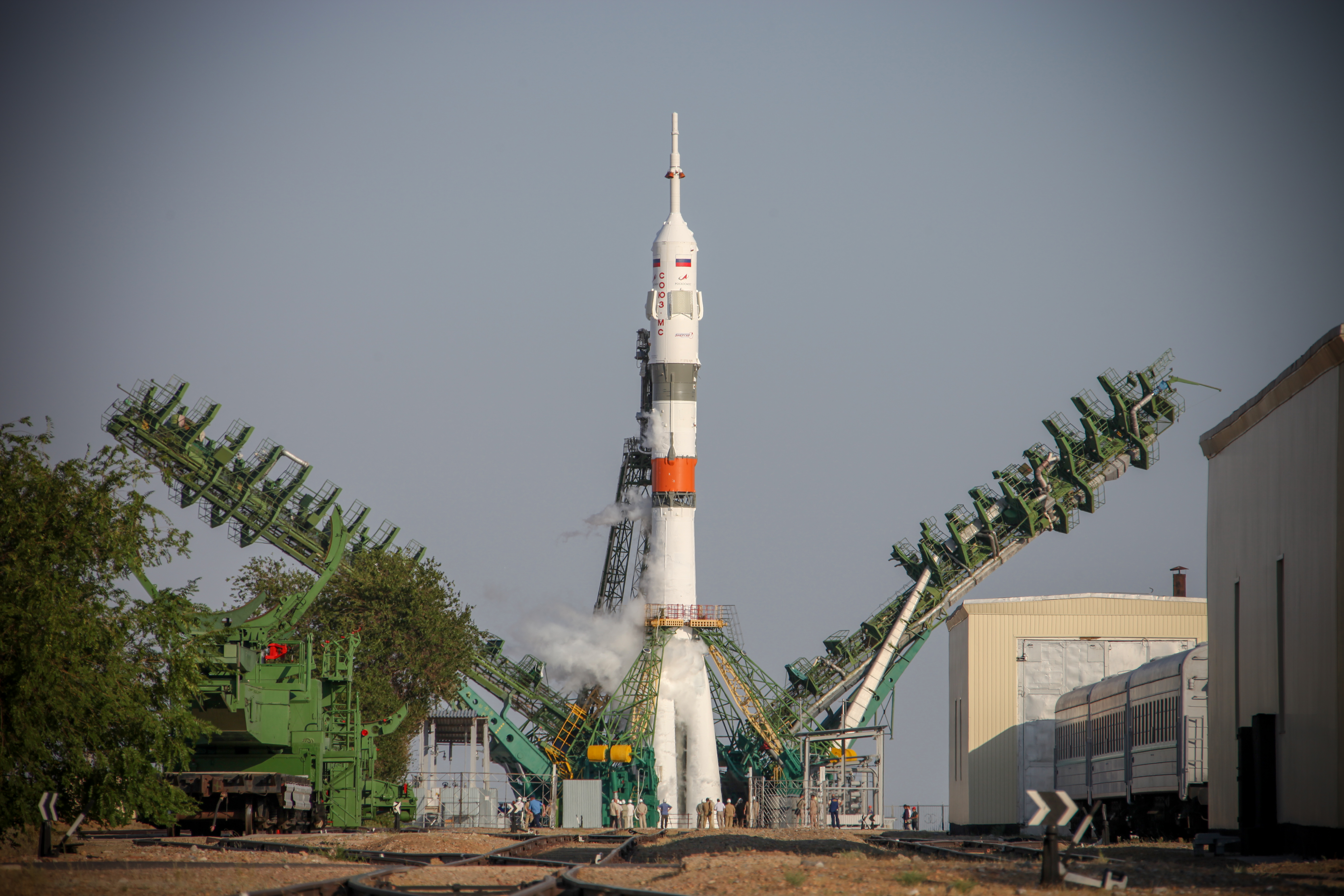
The city of Baikonur has a rare international status, and a unique status in Kazakhstan, being on a long-term lease to the Russian Federation. Baikonur is famous around the world for its cosmodrome from which space missions are regularly launched.
Sited on the territory of the Karmakshinsk district of Kyzylorda region, Baikonur has a population of around 76,255, of whom 35% are citizens of the Russian Federation, 62.5 % are citizens of Kazakhstan and 2.5 % are citizens of other countries. The city has a status corresponding to a city of federal importance of the Russian Federation, with a special regime for the safe operation of facilities, enterprises and organisations, as well as citizens’ personal wellbeing.
Russian legislation is currently in force in Baikonur (Kazakh law applies to Kazakhstan citizens) and the Russian rouble, along with the Kazakhstan tenge, is in circulation.
Entry is possible only through special passes, and tourists are advised to organise these well in advance of their visit.
History of the region
The foundation date of the region is considered to be 15th January 1938, when its territory was formed from areas withdrawn from South Kazakhstan region.
In the 1930s and 1940s, during the period of mass repressions and World War II, the population of the Kzyl-Orda region increased significantly due to deportees from other regions of the Soviet Union, especially Koreans from the Far East, and Volga Germans.
In 1997, by Presidential decree, the Kzyl-Orda region was renamed Kyzylorda region.
Climate and Nature
The majority of the region is within the Turan lowland; to the west is the coast of the Aral Sea. In the south-east there are spurs of the Karatau range, in the north-west are the sands of the Trans-Aral Karakum. On the left bank of the Syrdarya River is the Kyzylkum desert.
The Syrdarya River is the largest waterway of Kyzylorda, more than 1,000 km long. The Small Aral Sea, the northern part of this inland sea, is fed by the Syrdarya River; since the construction of the Kokaral dam in 2005 the water level in the Small Aral Sea has increased significantly, and the water has become less salty.
The climate of the region is continental, with a cold winter with little snow, and a very hot and dry summer. The average temperature in January is -13°C, and in July + 26° to 28°C, although summer heat often exceeds 40 °C. There is very little precipitation in the region.
Kyzylorda region has a significant potential for mineral resources. The most important minerals are hydrocarbons, lead, zinc, uranium, vanadium, and salt; the region is home to 15.1% of Kazakhstan’s zinc reserves, 9.6% of lead reserves, 13.7% of uranium, 4.7% of oil, gas and condensate, and 3.4% of groundwater.
Economy
In Kyzylorda region, priority is given to the mining industry and quarrying. In 2022, the share of this sector in the overall structure of industry was 71%, while the share of the manufacturing industry was 23.4%. It should be noted that in recent years this figure has been steadily growing.
The volume of production of agricultural products amounted to 180.1 billion tenge, including the share of crop production – 60.7% or 109.3 billion tenge, and the share of animal husbandry-37.2% or 67.0 billion tenge.
In Kyzylorda region, the main agricultural crop is rice, as well as cereals, vegetables, melons are grown here.
An important and constantly developing industry here is Fisheries. This case is strongly developed near the island. In 2022, the volume of fishing in the region amounted to 7386 tons. Of these, 4980 tons were sent for export.
The transport corridor "Western Europe – western China" passes through the territory of the region. In recent years, the construction and maintenance of the region's economy has given a significant boost.
Tourism
Historical and cultural monuments are well preserved on the territory of the region. To date, a list of 12 tourist routes and trails has been approved in the region. Of these, one of the most important tourist destinations is the Baikonur Cosmodrome. Many are very interested in the opportunity to watch the moment of flight of the rocket.
In addition, the Aral region is distinguished by its tourist potential (Barsakelmes Island, ship places, small Aral Sea, Kokaral Dam, Recreation Area on the shore of Lake Kambash), Korkyt Ata memorial complex, mountain massifs and Medical sanatoriums of Zhanakorgan District, Khankozha Lake in Shieli district.
In addition, the ruins of ancient cities such as Zhent, Syganak, Zhankent, Shyryk-Rabat are of particular interest to domestic and foreign tourists today.

