Меню

Digitalization
(as of 1 March 2021)
As part of the implementation of the state program "Digital Kazakhstan" in the West Kazakhstan region, a geoportal of local executive bodies is being created.
In 2019, a geoportal of the West Kazakhstan region was developed and implemented.
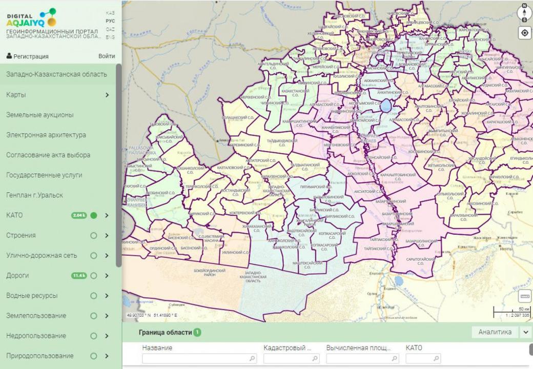
The resource is currently deployed at www.map.e-batys.kz.
The purpose of the geoportal is to provide access to information in the field of land relations and subsoil use for individuals and legal entities, as well as for business representatives, and to automate public services provided in these areas.
This geoportal presents schemes of free and granted land plots, as well as land plots put up for land auction for commercial and agricultural purposes, waiting lists for obtaining land for individual housing construction, free and transferred deposits, objects of the forest, water fund, hydraulic structures and main pipelines, roads and railways, engineering networks (water supply, sewerage, electricity, gas and heat supply), agricultural land, cultural and educational facilities, health and tourism, detailed design plans, master plans are also established.
In addition, the business processes of public services in the field of land relations and subsurface use in electronic form are automated through the geoportal.
Integration processes were implemented with the state databases of the real estate register and individuals, as well as with the information system of the address register. Currently, integration processes are being carried out with the unified state real estate cadastre information system, the e-government portal, as well as filling the geoportal with attribute data.
In addition, the number of public services (100%), the presence of GIS layers (100%), digitization of General plans (100%), the digitization project of detailed planning (100%), digitization of engineering systems for the city of Uralsk (73,5%), integration with the Unified state real estate cadastre is 50%, the willingness of geoportals a total of 87.3%.
The geoportal makes it possible to quickly manage land resources, provides access to citizens and organizations to its information resources. As well as a significant reduction in corruption risks, the exclusion of direct contact between the service recipient and the service provider.